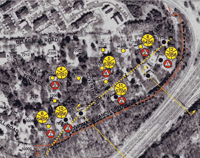
Aerial Diagram
This shows the proposed noise barrier as a black dotted line. The
current and projected sound levels (in dB) are shown in the yellow circles
for the various testing stations. The stations are shown as sequentially numbered
orange triangles. The other number in each yellow circle is the dB reduction.
The yellow dotted line shows the 66 dB line.
The dark dots show currently "impacted" homes (66 db or higher noise levels).
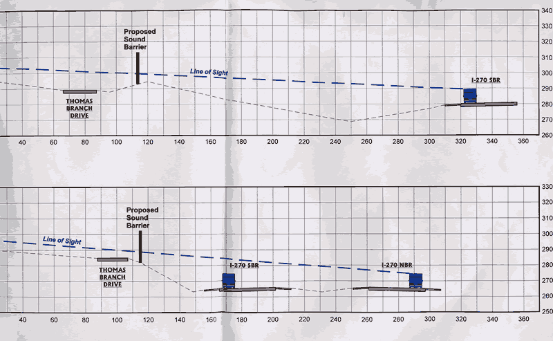
Elevation Diagram
These two diagrams show an elevation view of the proposed barrier. The top diagram shows
how the barrier is positioned opposite 7201 Thomas Branch Drive. The bottom diagram shows
the barrier opposite 7111 Thomas Branch Drive. Scale is in feet. Both reflect the original plans which the
state presentated to the community June 13. We are pushing to move the barrier another 10' further from
Thomas Branch Drive.
 Home
Home